Go Back
GeoAnalysis Tools
GeoAnalysis Tools is an ESRI extension for ArcScene that is used to analyze the
orientation of features in surface and point cloud models of geological
outcrops. The extension allows for the viewing, rotation, and editing of
oblique 3D surfaces and point clouds. This is particularly effective on 3D
surface models created from terrestrial LIDAR point clouds and that have been
draped with photographs of the outcrop. The analysis displays and saves the
results and provides for the placement of polylines, polygons, and surfaces to
represent the results of the analysis. For example, the result of a Strike-Dip
calculation can be displayed as a 3D polygon in the model. All results of the
analyses are saved in the attribute table with fields provided for naming and
sorting.
The focus
to date has been on the structural features of an outcrop. The tools that have
been implemented so far are listed below. Over the next two years we will
develop tools that are directed toward the analysis of sedimentary features of
geological outcrops.
Tools
such as random distance and orthogonal distance may have application to studies
of manmade features. The tool set is also being adapted for use in the
LaserSketch tool, which uses a laser range finder or total station to map
features of an outcrop or a manmade structure.
General Tools
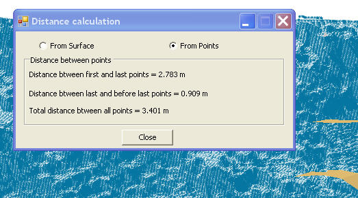
Distance
measurement
Orthogonal
distance measurement to a selected surface
Insertion of
polylines and polygons
Structural Related Tools
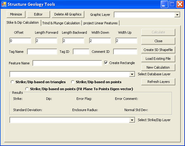
Strike-Dip from
three or more selected points or from selected triangles of a TIN model
Trend-Plunge
from two points or from the intersection of two polygons representing the limbs
of a fold
Bedding
thickness
Extrusion of a
linear trace of points (e.g. bedding of a fold) as a surface in a Trend-Plunge
direction
Rapid
classification of the orientation of all surfaces in a TIN model
Down-plunge cross-section (2D) of a
fold or other structures (displayed in ArcMap)
Download description of the tool in windows media
video (.wmv) format (~46MB)
Software Gallery
| Structure geology tools
 |
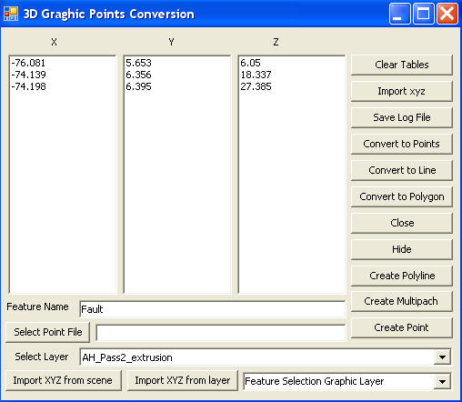
ArcScene Points converter
 |
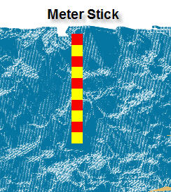
ArcScene Meter stick
 |
ArcScene Distance calculator
 |
| Point Cloud Builder
 |
Graphic remover
 |
ArcScene Campus
 |
GeoAnalysis Tool Bar
 |
Go Back
|