Go Back
Laser Sketch
Laser Sketch is an ESRI
ArcMap/ArcScene extension that enables the real-time mapping of points from a
laser range finder or a total station to their correct position on a photograph.
Laser Sketch uses the camera lens distortion parameters to correctly place the
point measured by the laser instrument. The lens distortion parameters can be
obtained using free ware programs or commercial programs such as MatLab®
and Photo Modeler®. The distortion parameters need to be measured
only once for each camera/lens combination. The parameters are saved in the
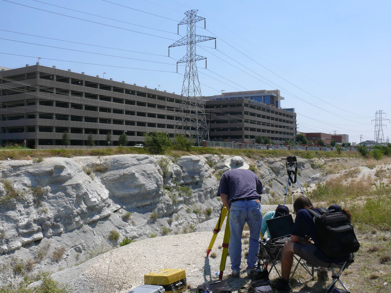
Laser Sketch directory on the laptop. The laptop is connected to a laser
instrument that has a traverse and elevation capability. We currently have
drivers for some Topcon® and some Laser Atlanta®
instruments.
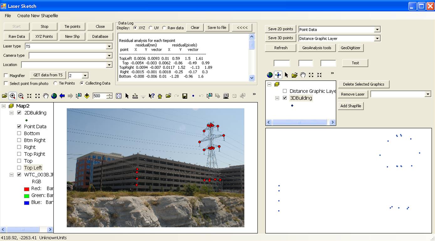
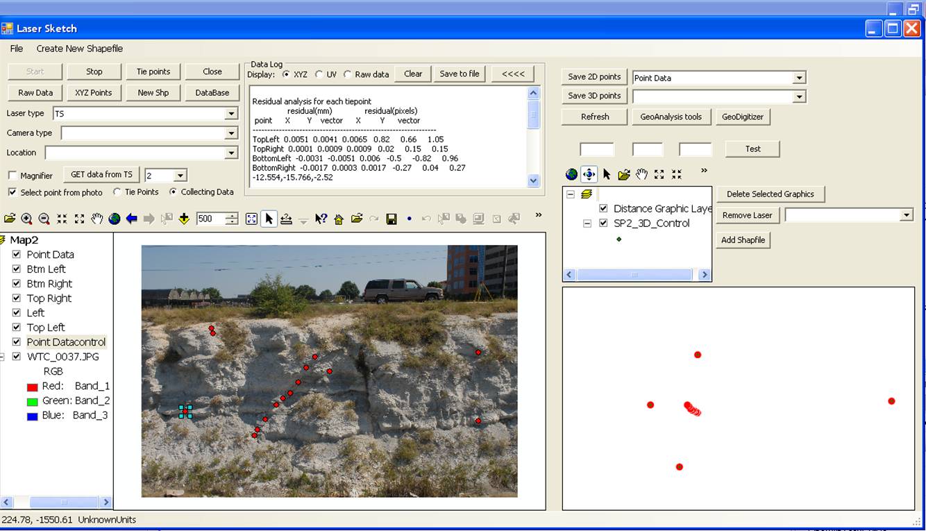
A photograph of the target
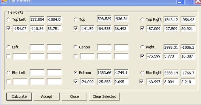
area is taken with the camera and loaded into Laser Sketch. Four tiepoints are
selected between the target and the photograph. A graphic marker is placed in
the photograph and the XYZ location of the point is measured with the laser
instrument. After the four tiepoints are captured, the 3D to 2D transformation
parameters that relate the target to the photograph are calculated. All
subsequent points that are shot with the laser instrument are plotted on the
photograph in their approximately correct position. Accuracy of less than two
pixels in placement of the points is easily achieved with a total station.
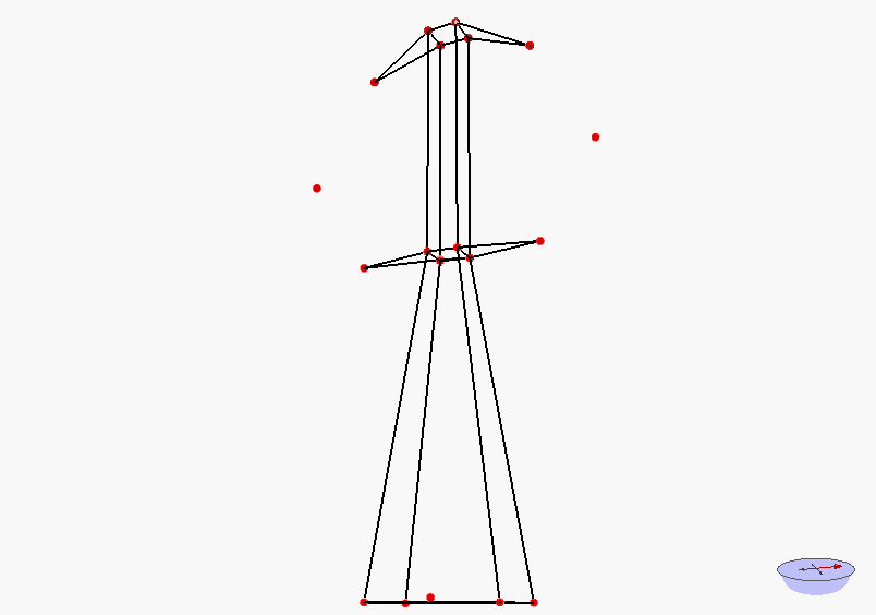
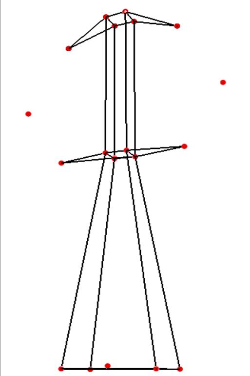
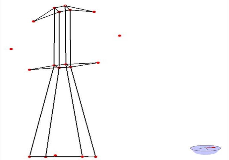
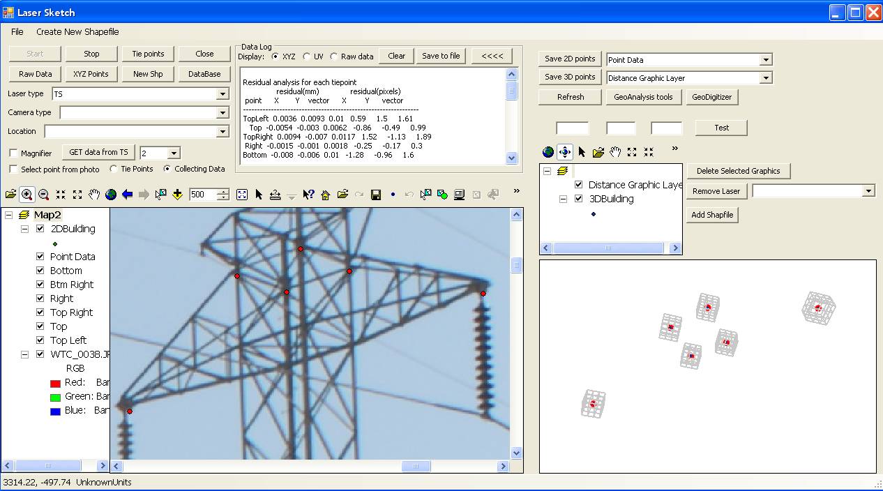
The resulting points can be
displayed in 3D mode in an ArcScene window in Laser Sketch. The points can be
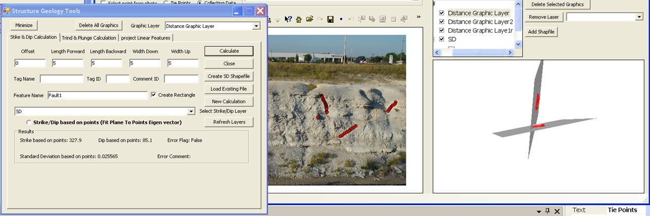
converted into 3D polylines and 3D polygons. For geological outcrops, the point
based tools in GeoAnalysis Tools can be used to analyze the orientations of the
features which have been sketched.
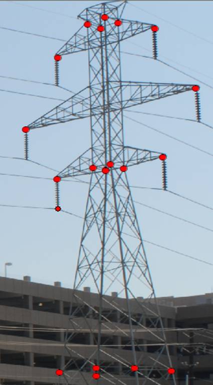
Electric tower created from
digitized 3D points using Topcon Total Station and Laser Sketch program
-
One time distortion characterization of
camera and lenses.
-
Photograph target
-
Load photograph in Laser Sketch (ArcMap/ArcScene)
-
Identify a tiepoint in Laser Sketch with
graphic marker and shoot XYZ location with laser/total station
-
Repeat until at least four points have been
selected
-
Calculate 3D => 2D transformation
parameters, repeat process if residuals are unsatisfactory
-
All subsequent XYZ points that are shot will
be plotted on the photograph in real-time. Points can be named and
attributed at time of capture
Software Gallery
| Tie points and residuals
 |
Tie points
 |
Field Work
 |
| Digitized point on photo
 |
Digitized point in 3D
 |
Video of points converted to lines in 3D
 |
| Analyzed digitized points
 |
Digitized geology feature
 |
The points in 2D and 3D
 |
Go Back
|